这些地图将改变你看待世界的方式

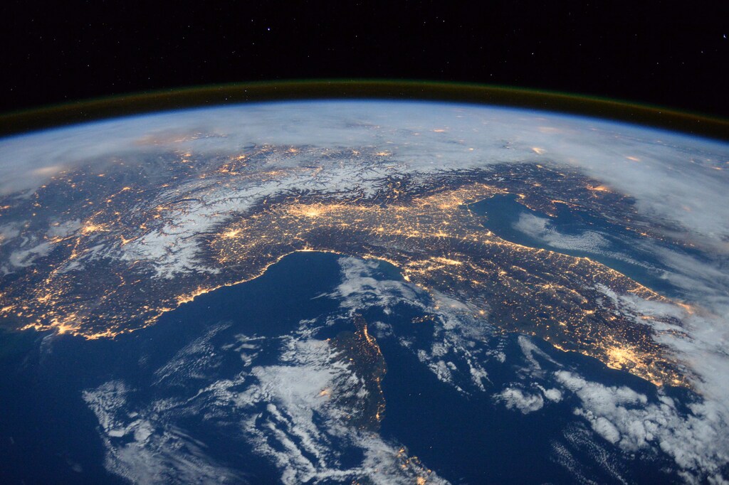
A photo taken by Expedition 46 flight engineer Tim Peake of the European Space Agency (ESA) aboard the International Space Station shows Italy, the Alps, and the Mediterranean on January, 25, 2016. REUTERS/NASA/Tim Peake/Handout ATTENTION EDITORS - FOR EDITORIAL USE ONLY. NOT FOR SALE FOR MARKETING OR ADVERTISING CAMPAIGNS. THIS PICTURE WAS PROVIDED BY A THIRD PARTY. REUTERS IS UNABLE TO INDEPENDENTLY VERIFY THE AUTHENTICITY, CONTENT, LOCATION OR DATE OF THIS IMAGE. THIS PICTURE IS DISTRIBUTED EXACTLY AS RECEIVED BY REUTERS, AS A SERVICE TO CLIENTS - RTS8V3O
Most maps, like the Mercator projection, distort the size or shape of land masses.Image: REUTERS/NASA
本内容由人工智能自动翻译。

地图都不完美,因为它们只能用二维方式呈现地球。大多数地图,例如墨卡托投影,会扭曲陆地的大小或形状,从而影响我们对各大洲和国家彼此相对大小的认识。

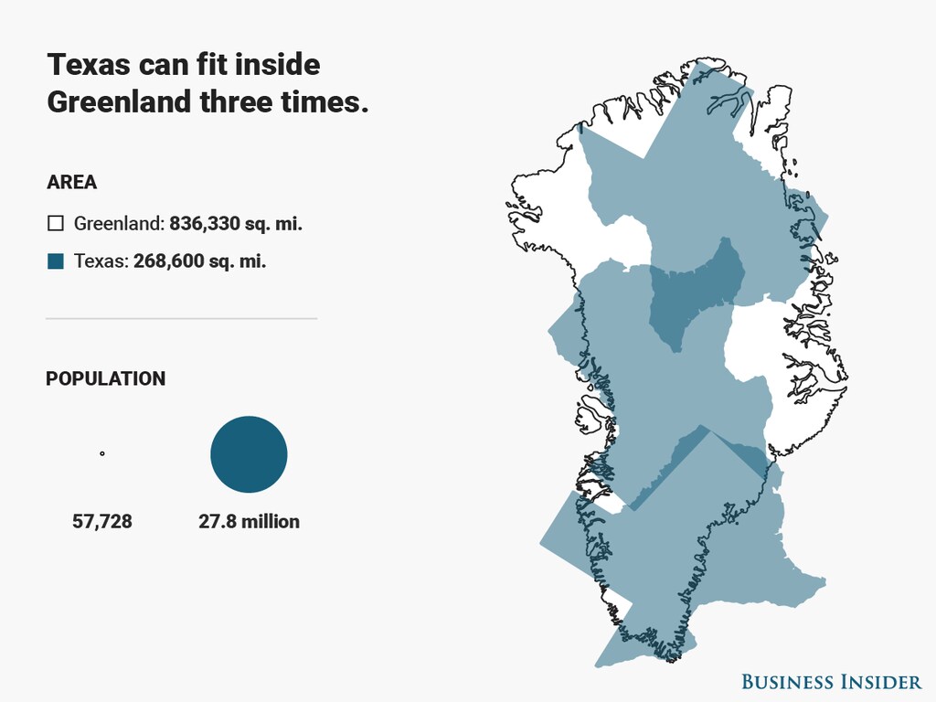
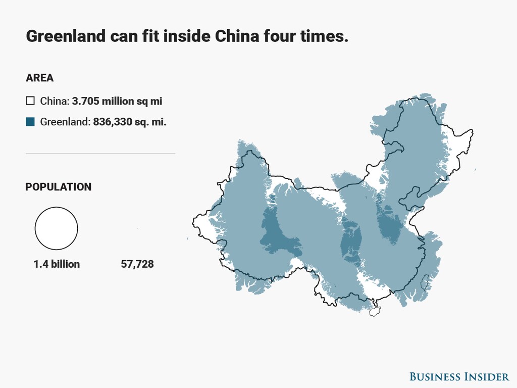
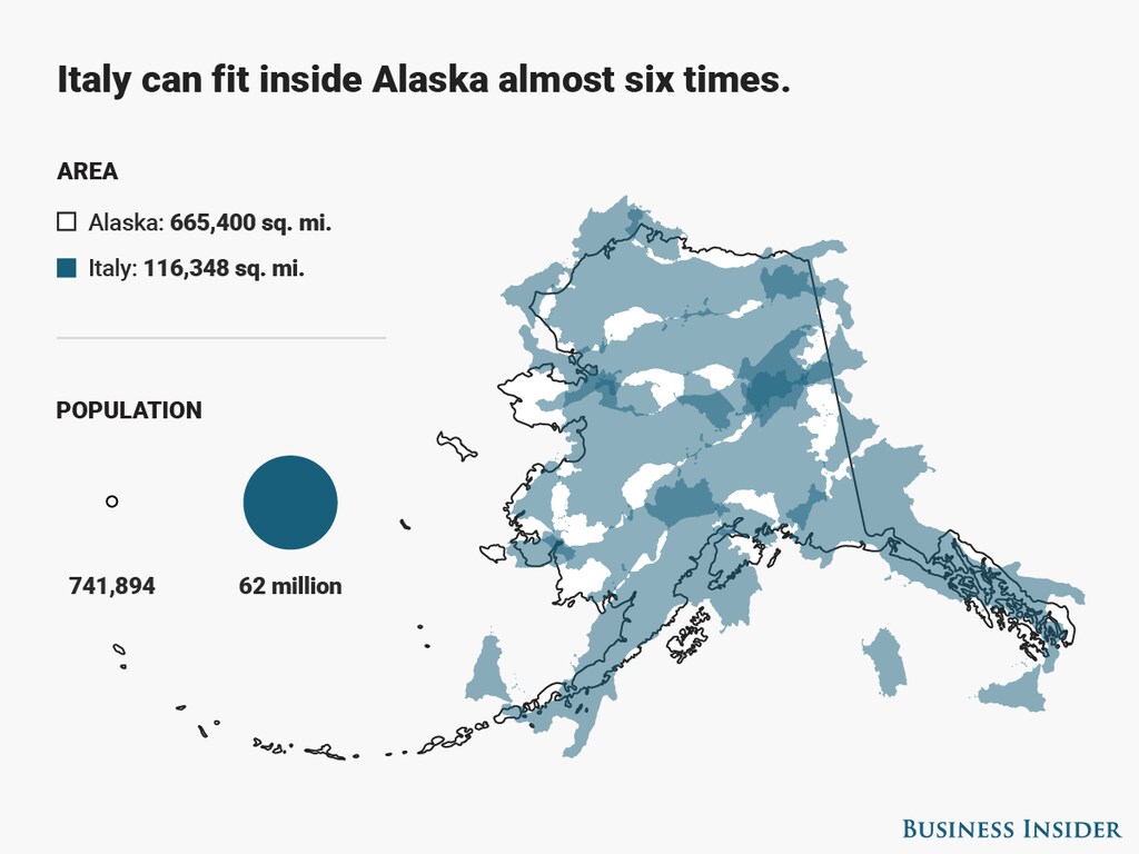
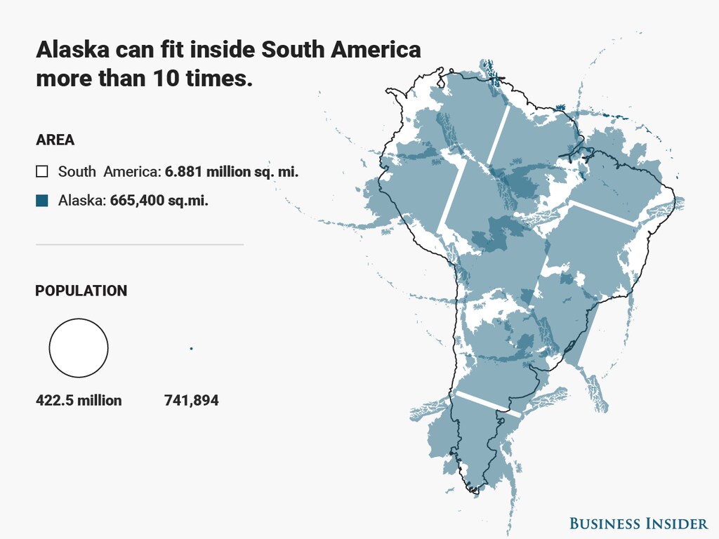
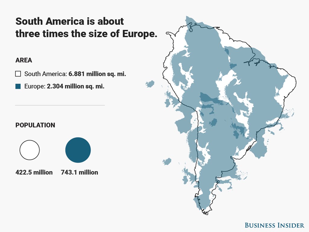
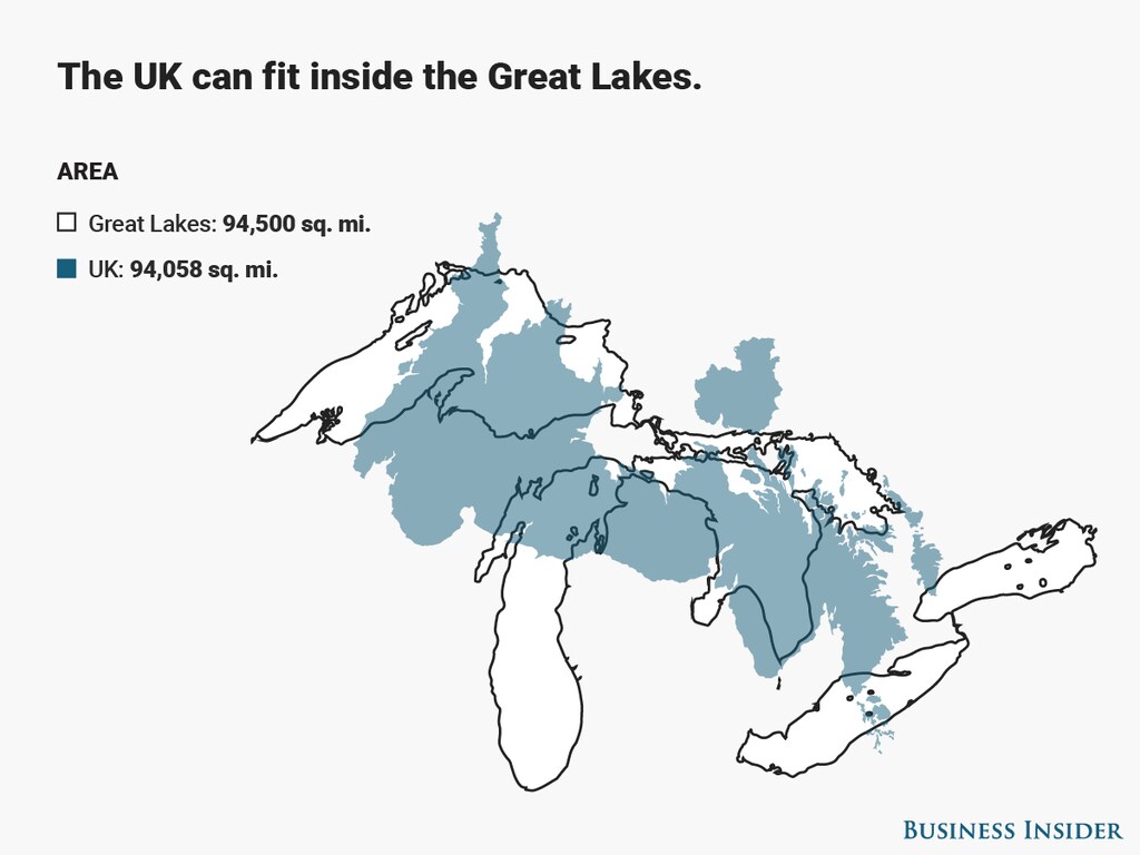
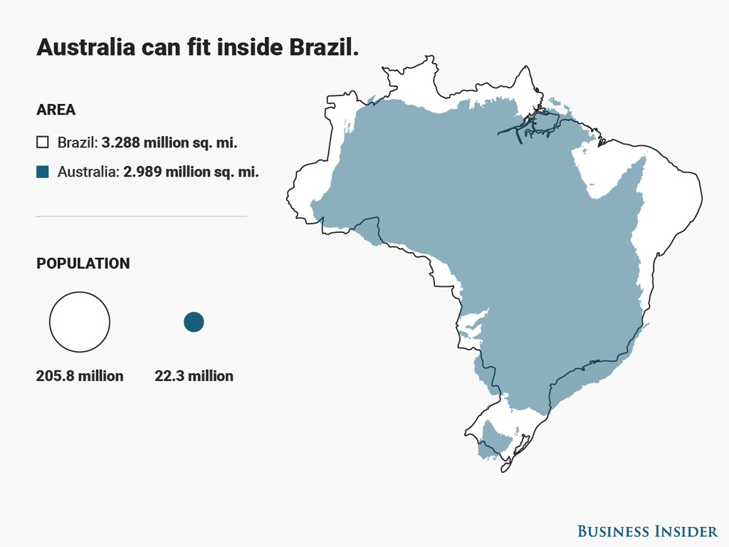
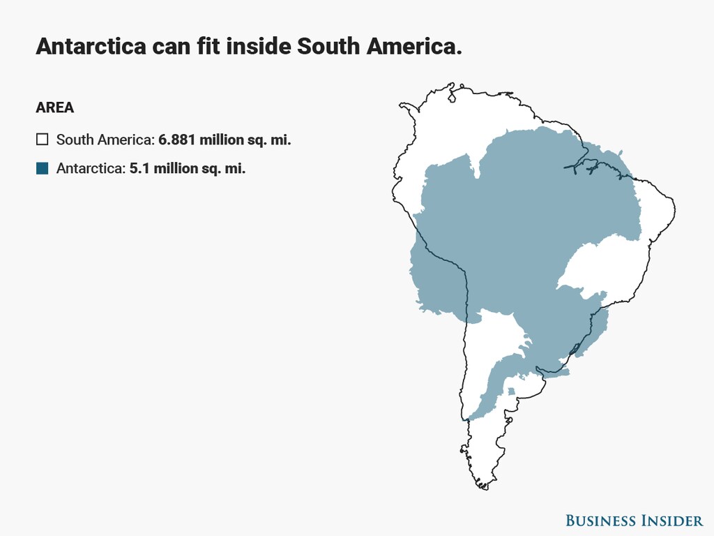
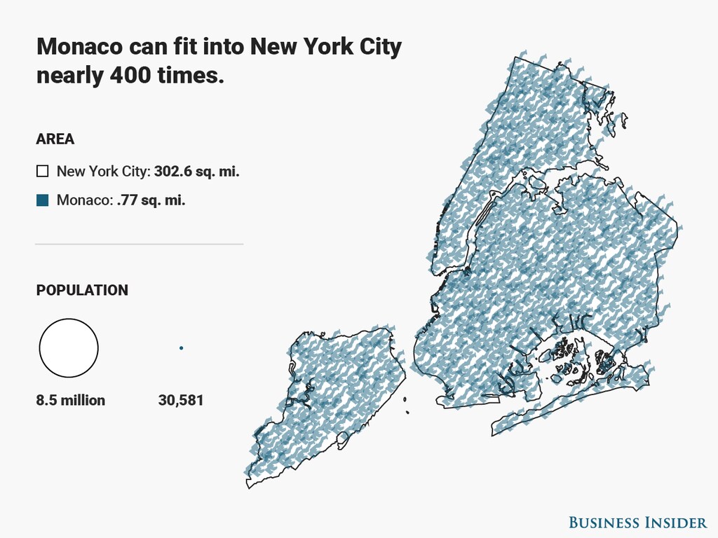
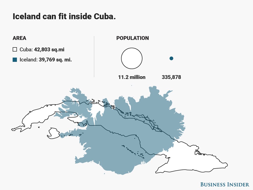
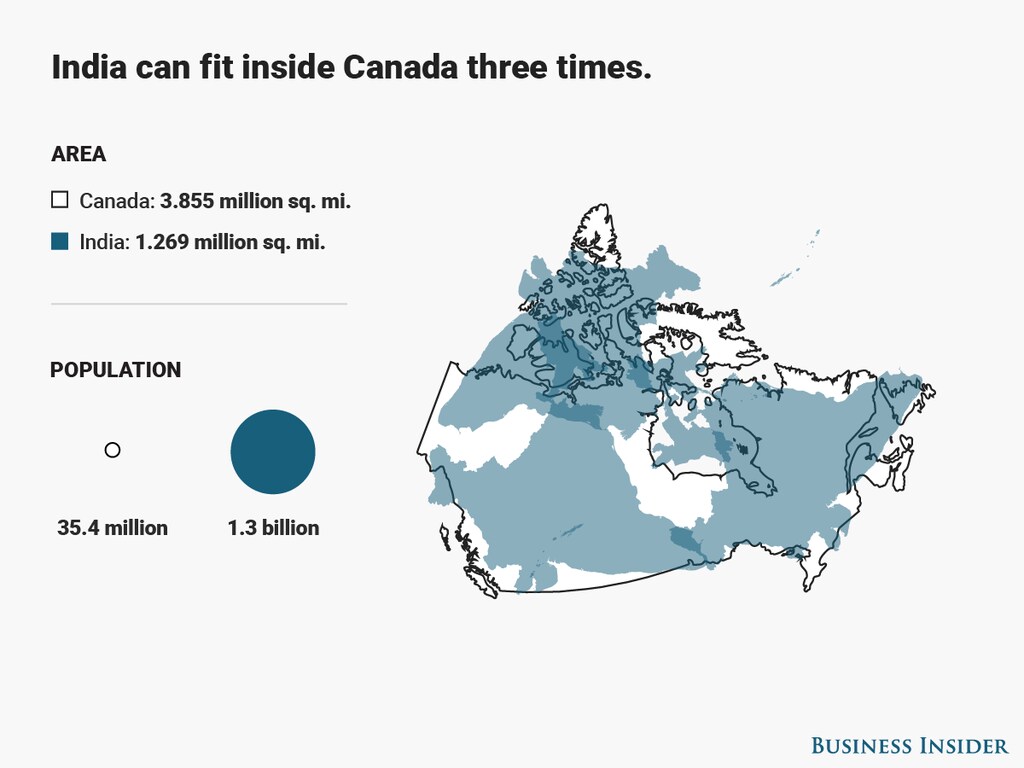
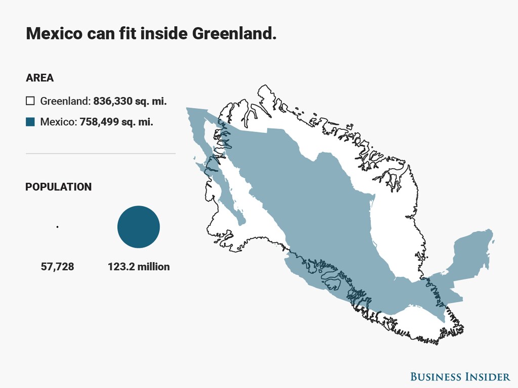
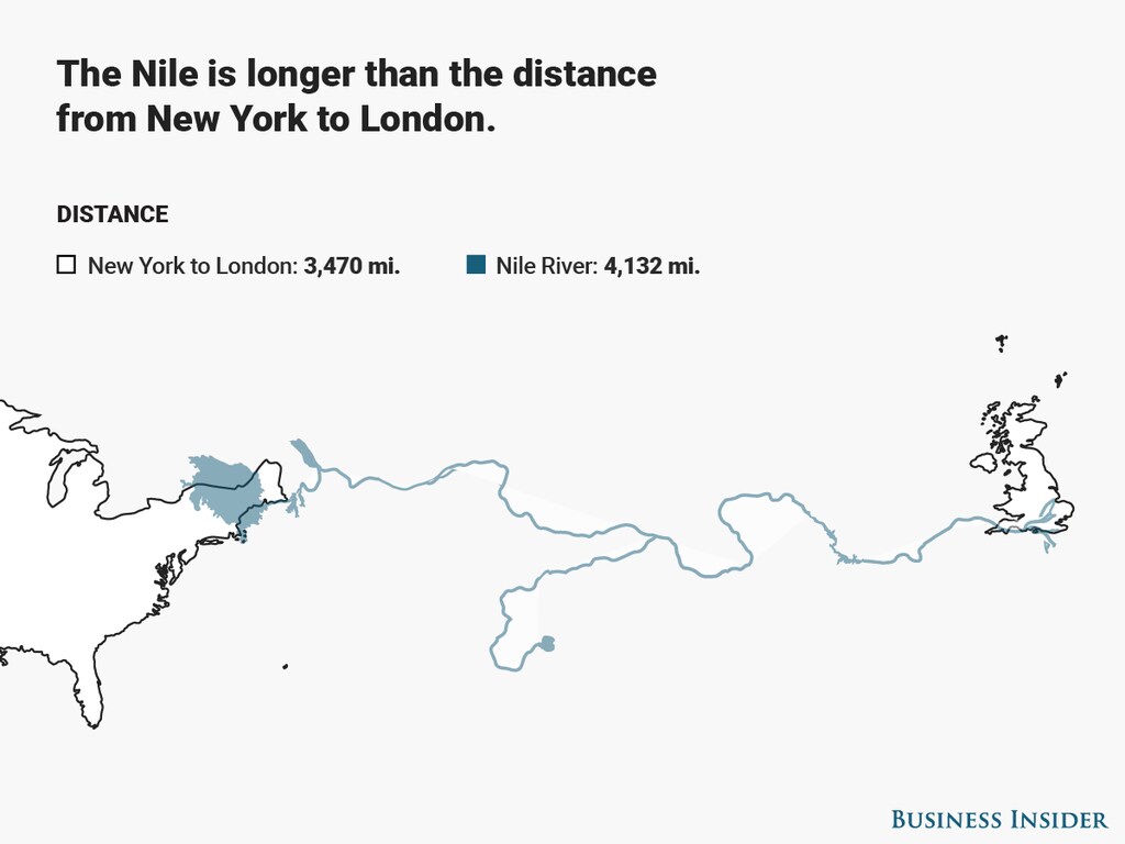
不过,若从面积来看,一个全新的世界便会呈现出来。受德国平面设计师凯·克劳泽绘制的这幅展示非洲真实面积的地图启发,我们制作了15幅地图叠加图,让你重新认识真实的地理面貌。
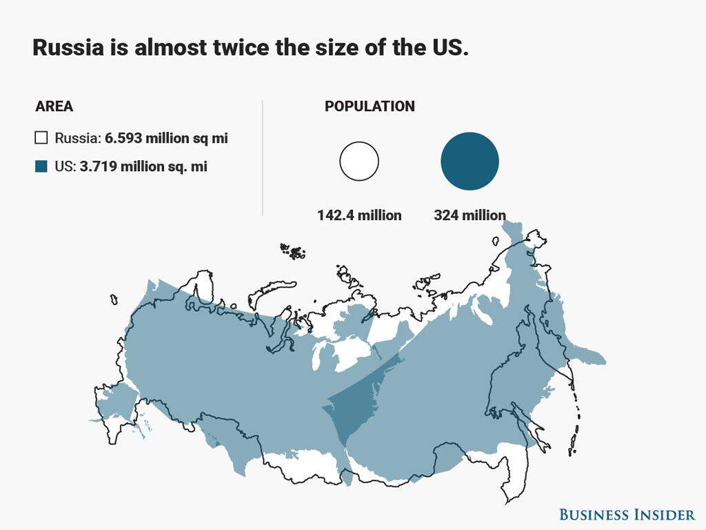
Image: Diana Yukari/Business Insider
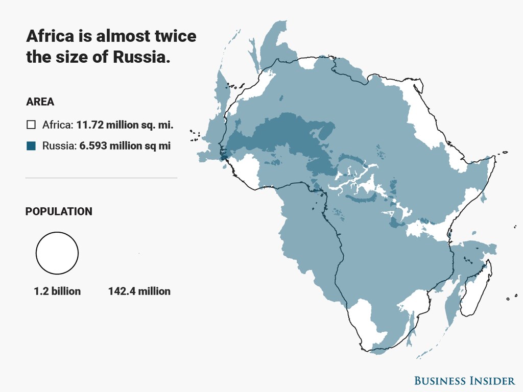
授权与转载
世界经济论坛发布的文章,可依据《知识共享署名-非商业性使用-禁止演绎4.0国际公共许可协议》以及我方《使用条款》进行转载。 本文所表达的观点仅代表作者个人立场,并不代表世界经济论坛的观点。